2027年までのヨーロッパ水路測量市場予測 - 新型コロナウイルス感染症の影響とコンポーネント(ソフトウェアおよびサービス)およびエンドユーザー(海洋、石油およびガス)ごとの地域分析
No. of Pages: 100 | Report Code: TIPRE00021043 | Category: Technology, Media and Telecommunications
No. of Pages: 100 | Report Code: TIPRE00021043 | Category: Technology, Media and Telecommunications
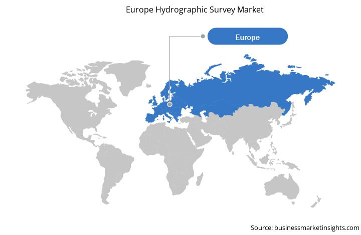
ドイツ、フランス、イギリス、イタリアは、ヨーロッパの水路測量市場に大きく貢献している国のひとつです。この地域の市場は、生態系やボート利用者の安全のために水路調査を必要とする海洋プロジェクトの増加によって推進されています。たとえば、アイルランド、北アイルランド、スコットランドの水路調査プロジェクトは、海事沿岸警備隊 (MCA) が船舶輸送の増加、海洋保護区、海洋再生可能エネルギーから得られる優先地域を特定した後に設計されました。 MCA は、ゴールウェイ海洋研究所、北灯台委員会、アイルランド地質調査所、農業食品生物科学研究所のパートナーとともにプロジェクトを主導し、その情報は英国水路局に提供されました。この地域のいくつかの政府機関は、港湾の水路調査、探査、その他の活動を実施しました。たとえば、測量を担当するデンマーク国有の中央機関であるデンマーク地理データ局は、デンマークで水路測量と海図作成を行っています。デンマーク、フェロー諸島、グリーンランド近海の海図を作成します。調査はデンマーク海軍の人員と船舶によって実施されます。海上貿易と輸送の成長、および海洋石油と海洋の数の増加。ガスプロジェクトは、ヨーロッパの水路測量市場の成長を牽引する主な要因です。
さらに、新型コロナウイルス感染症(COVID-19)の発生により、ロシア、英国、フランス、スペイン、イタリア、ドイツは最悪の国の一部となっています。欧州地域の加盟国に影響を与えた。この地域の企業は、操業を停止するか、活動を大幅に縮小しなければならず、深刻な経済的困難に直面している。ビジネスのロックダウン、渡航禁止、サプライチェーンの混乱により、この地域では2020年に経済減速が見られ、2021年半ばまで続く可能性が最も高い。イタリア、スペイン、ドイツなどの欧州加盟国は、国民の間でのコロナウイルスの感染拡大を制限するため、抜本的な措置や渡航制限を実施している。ヨーロッパ諸国は、海洋の安全性と石油と石油の繁栄における導入と成長の増加により、水路測量の主要市場を代表しています。ガス産業。しかし、新型コロナウイルス感染症の影響で、欧州諸国では水深解析などのための水路測量を必要とする大型海洋プロジェクトがプロジェクト停止により大幅に減少している。これらの要因は、ヨーロッパ諸国の水路測量市場の成長に直接的な影響を与えると予想されます。ロシア、イタリア、ドイツ、英国、フランスの水路測量市場は、2021 年半ばまで最悪の影響を受けると予想されます。
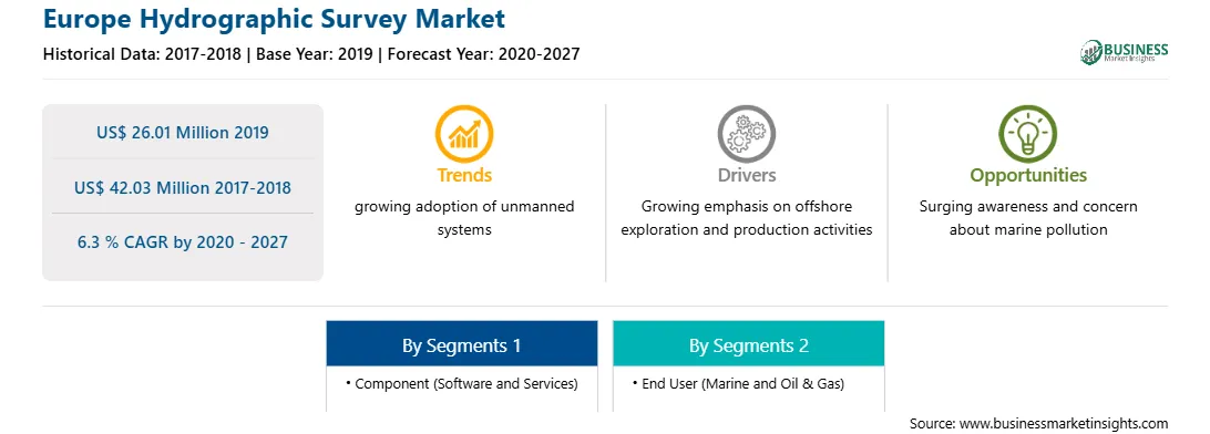
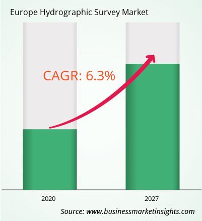
ヨーロッパの水路測量市場は、2019 年の 2,601 万米ドルから 2027 年までに 4,203 万米ドルに成長すると予想されています。 2020 年から 2027 年までに 6.3 % の CAGR で成長すると推定されています。水路測量ソフトウェアとサービスの技術開発により、ヨーロッパの水路測量市場が加速すると予想されます。水路測量士は、海洋環境を特定し、航行の安全のための海図を作成する上で重要な役割を果たします。水路調査の主な役割に加えて、エンドユーザーは海洋資源の持続可能な管理と沿岸インフラの保護のためのリアルタイム データをますます求めています。沿岸地域の気候変動と都市化に関連する課題を管理するには、水路データが必要です。したがって、水路測量とこの分野の専門家の役割はパラダイムシフトを経験しており、破壊的なテクノロジー、ソリューション、技術の導入の増加により、測量能力と生産性が向上し、同時に関連するリスクとコストが軽減される可能性があります。人工知能 (AI)、仮想現実 (VR)、自動データ収集などの先進技術の統合が、水路測量業界のさらなる発展における次のステップとして浮上しています。 AI、機械学習 (ML)、および将来予測ソナー (FLS) により、水路データの収集、処理、分析、プレゼンテーションが変革されます。この技術統合により、数年以内に水路データをほぼリアルタイムでクラウドに送信できるようになるでしょう。さらに、複雑なアルゴリズムと AI を使用してデータを処理するいくつかの方法が開発段階にあります。 AI および ML 機能の導入により、企業は製品中心からデータ中心に移行することができ、これにより企業は製品とサービスのポートフォリオを拡大でき、それによって顧客満足度を高めることができるようになります。先進技術は海洋、石油、海洋分野で急速に注目を集めています。ガス部門、および先進技術と統合された水路測量ソフトウェアの使用の増加が、ヨーロッパ市場の顕著な傾向として浮上しています。
コンポーネントの観点から見ると、2019 年のヨーロッパの水路測量市場ではソフトウェア部門が最大のシェアを占めました。 2019 年のヨーロッパの水路測量市場では、ガス部門がより大きな市場シェアを占めました。
ヨーロッパの水路測量市場に関するこのレポートを作成するために参照されたいくつかの主要な一次および二次情報源は、企業の Web サイト、年次報告書、財務報告書、政府文書、統計データベースなどです。レポートに記載されている主要企業は、BeamworX BV、Esri、Eye4Software BV、HYPACK / Xylem Inc.、IIC Technologies、Moga Software srl、Norcom Technology Limited、OceanWise Limited、Quality Positioning Services BV (QPS)、Teledyne Marine (Teledyne Technologies Incorporated) です。 .
Strategic insights for Europe Hydrographic Survey involve closely monitoring industry trends, consumer behaviours, and competitor actions to identify opportunities for growth. By leveraging data analytics, businesses can anticipate market shifts and make informed decisions that align with evolving customer needs. Understanding these dynamics helps companies adjust their strategies proactively, enhance customer engagement, and strengthen their competitive edge. Building strong relationships with stakeholders and staying agile in response to changes ensures long-term success in any market.
| Report Attribute | Details |
|---|---|
| Market size in 2019 | US$ 26.01 Million |
| Market Size by 2027 | US$ 42.03 Million |
| Global CAGR (2020 - 2027) | 6.3 % |
| Historical Data | 2017-2018 |
| Forecast period | 2020-2027 |
| Segments Covered |
By コンポーネント
|
| Regions and Countries Covered | ヨーロッパ
|
| Market leaders and key company profiles |
The regional scope of Europe Hydrographic Survey refers to the geographical area in which a business operates and competes. Understanding regional nuances, such as local consumer preferences, economic conditions, and regulatory environments, is crucial for tailoring strategies to specific markets. Businesses can expand their reach by identifying underserved regions or adapting their offerings to meet regional demands. A clear regional focus allows for more effective resource allocation, targeted marketing, and better positioning against local competitors, ultimately driving growth in those specific areas.
The Europe Hydrographic Survey Market is valued at US$ 26.01 Million in 2019, it is projected to reach US$ 42.03 Million by 2027.
As per our report Europe Hydrographic Survey Market, the market size is valued at US$ 26.01 Million in 2019, projecting it to reach US$ 42.03 Million by 2027. This translates to a CAGR of approximately 6.3 % during the forecast period.
The Europe Hydrographic Survey Market report typically cover these key segments-
The historic period, base year, and forecast period can vary slightly depending on the specific market research report. However, for the Europe Hydrographic Survey Market report:
The Europe Hydrographic Survey Market is populated by several key players, each contributing to its growth and innovation. Some of the major players include:
The Europe Hydrographic Survey Market report is valuable for diverse stakeholders, including:
Essentially, anyone involved in or considering involvement in the Europe Hydrographic Survey Market value chain can benefit from the information contained in a comprehensive market report.
Office No. 1011, First floor, Farena Corporate Park, Magarpatta-Mundhwa road, Pune - 411028, Maharashtra, India
US:+16467917070
sales@businessmarketinsights.com


 Get Free Sample For Europe Hydrographic Survey Market